By Mariusz Koper
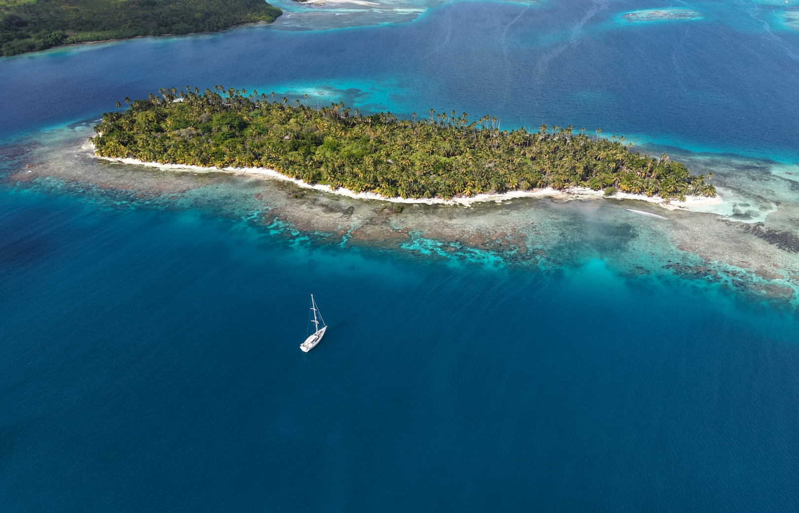
The goal that I set myself, my crew, and Katharsis II in 2012 was to complete the North-West Passage from east to west. Since 1906, with the first crossing of the Passage by Roald Amundsen, only 65 sailboats have successfully completed the crossing. I am proud to add Oyster and my name to that list.
Arctic ice tends to be less threatening than it was a dozen or so years ago, as global warming is diminishing the permanent ice cap. Navigation is facilitated due to the highly accurate forecasts published by the Canadian Ice Service. Nevertheless, the ice in the Arctic has not yet completely disappeared and so a voyage through the daunting North-West Passage was very dramatic last year, thanks to the large concentration of ice in the Eastern Arctic.
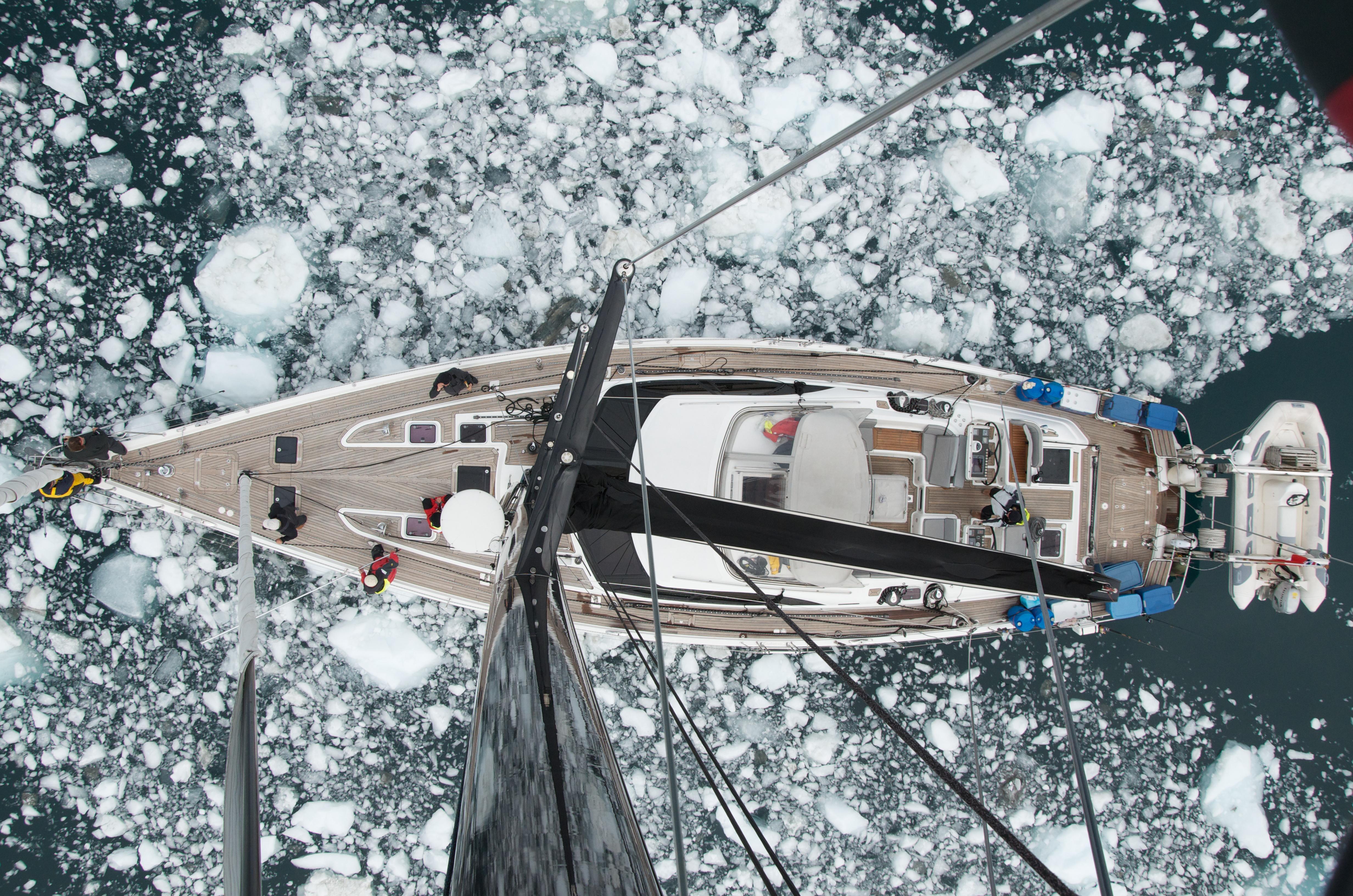
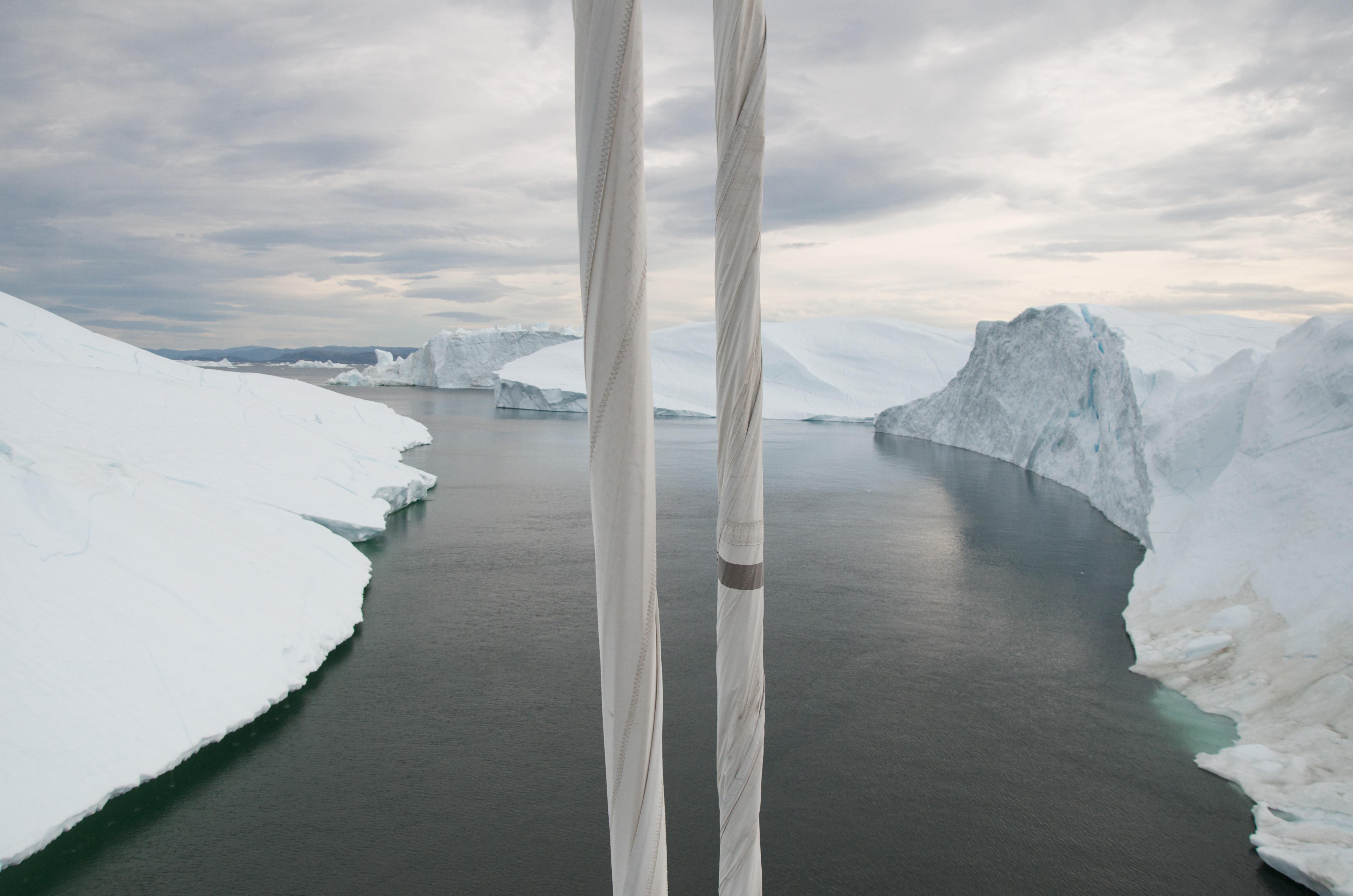
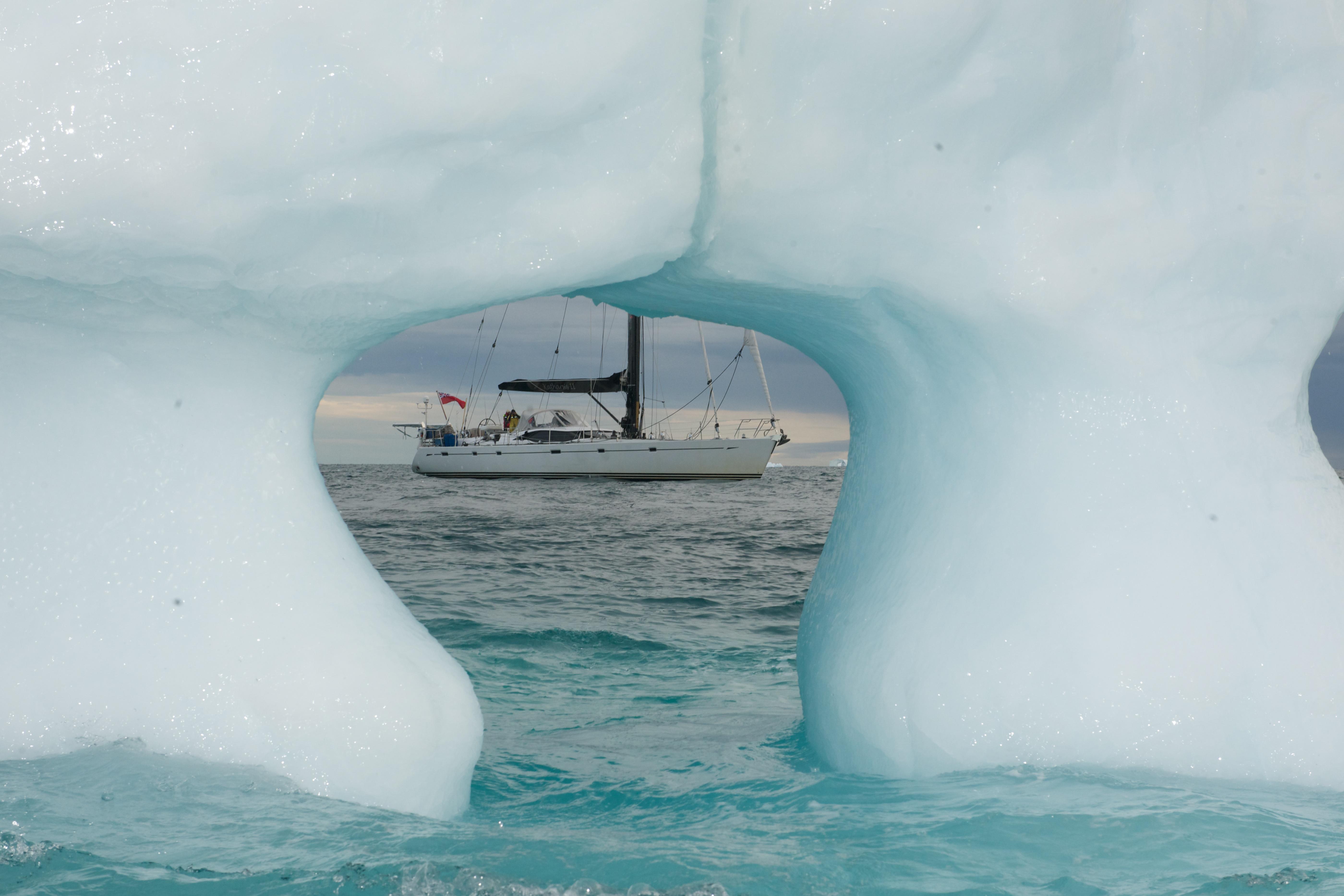
We had our first Arctic experience in Greenland towards the end of July. We sailed to the port of Ilulissat in Disko Bay in calm and sunny weather. In order to reach the harbour, we had to successfully manoeuvre Katharsis II through a field of massive icebergs. I had never seen so many icebergs in one place before. They break, or calve, from the most productive glacier in the world – Sermeq Kujalleq. It was a magical feeling to be surrounded by these towering walls of ice glittering with all shades of snow white and icy blue.
During our short stay in the port, the weather deteriorated. Rain and strong winds started to blow from the land and changed the face of the bay. After just a few hours, ice floe and growlers began to fill up the harbour. Due to their size and number, it seemed that the safest thing to do was to leave the port. So we left, but unfortunately, the situation outside was deteriorating as well. The strong wind created currents, setting the ice in motion. We watched as streams of growlers moved in opposite directions. These conditions, combined with the growing fog, forced us to return to the safety of the harbour.
We found refuge behind a cliff near the port entry, thus avoiding direct contact with the swirling ice. Although we avoided any collisions, we were completely blocked in by a white mass of ice. The next day, the ice began to leave the harbour. This made it possible for the 100m clipper Adventure to leave Ilulissat. However we had moored behind the ship and were still trapped in ice. We had only four ice poles to protect our hull against the pressure of the ice, which was put into motion by one of the ship’s propellers. We experienced several direct hits, but were otherwise left unscathed. The next day we were also able to leave the port of Ilulissat.
There is usually a large ice massif in the central part of Baffin Bay in July. Because of this, a detour is required. However, the melting of ice this year made it possible to sail directly towards the Canadian Arctic. On the other hand, the Eastern Arctic is usually free of ice in July, but this year the passage from Pond Inlet to Lancaster Sound was completely blocked in early August. Lancaster Sound itself, especially in the southern part, was also filled with ice. The pack ice began to flow out of the sound into Baffin Bay in the form of a long belt. We encountered its edge with two nautical mile accuracy on 4th August, and thus confirmed the quality of the Canadian ice charts. The pack ice was very impresive. We could hear the frightening sound of the ice bobbing in the swell. It cer tainly did not encourage us to enter inside.
We passed by Pond Inlet and sailed directly into the northern part of Lancaster Sound. Entry into the Canadian channels marks the beginning of the North-West Passage. In the middle of Devon Island’s south coast we encountered our first pack ice, which could not be detoured. After several hours of manoeuvring through the maze, the newly downloaded ice chart confirmed that we were in pack ice with an ice concentration of 7/10, which extended well into Maxwell Inlet. We expected to be in drift ice with an ice concentration of 3/10, as indicated by the previous day’s forecast. Sailing close to the shore, due to the absence of wind and surge, we were able to break through to clear water, after ten long hours of negotiating the ice.
On the evening of 6th August we anchored in Erebus and Terror Bay, between the islands of Devon and Beechey. Here, John Franklin’s tragic expedition spent their first winter of 1845 in this Martian-looking environment. It was one of the most tragic Arctic expeditions. None of the 129 participants survived.
We continued our journey south. I decided to go through Peel Sound because there was no ice forecast issued for Prince Regent Inlet at the time. On the way to Somerset ’s west coast, we met a huge (about 10 km 2 ) ice island, which had calved from the Peterman Glacier in Greenland. It was more an attraction for us rather than an obstacle. It was easy to imagine that if the currents and winds had shifted it into one of the narrow passages, one would have been totally blocked. The ice island seemed to be completely intact. It was carved with canyons filled with icy rivers. We couldn’t resist the temptation to explore it a bit. It left a great impression on my crew.
Being well ahead of our schedule, I decided to visit Fort Ross on the east side of Somerset. To get there, we had to cross Bellot Strait. This narrow, 18-mile-long pass is tricky because of its strong currents which can cause a rapid change of ice conditions. We encountered a clear entry, but exit on the eastern side looked like a flowing mountain stream filled with ice. We faced 6 knots of current there. Fortunately, there was a narrow, ice-free path through the mainstream. We suffered only one direct hit by a large ice floe. It was turned into fast motion by the current and with side wind picked up to 25 knots, we couldn’t avoid it. T here was no damage to the boat as the ice only licked our port hull. We passed the strait, but the drama was still unfolding. The entrance to Fort Ross was blocked by several miles of long, thick rings of ice floe. I was hoping the ice wouldn’t have filled up the strait on the way back to Peel Sound. We broke through the barrier of ice at last and dropped an anchor in the bay, which housed the remains of a Hudson’s Bay Company outpost closed in the 1940s. One of the buildings still serves as a self-service shelter. I filled in the guest book as the first yacht visiting Fort Ross in 2012. We met several polar bears, one of whom even tried to board the boat, tempted by the smell of freshly cooked lobster pasta. Nothing worked to discourage him, so I had to use our rifle to make a shot in the air. The way back was much easier despite strong head winds, which fortunately dispersed the ice, so the east entrance to Bellot Strait was clear this time. Shortly afterwards we found out that Katharsis II was the first vessel ever passing Bellot Strait twice during a single voyage.
At this point, I had another decision to make: which side of King William Island should we choose on the way to Queen Maud Gulf? Amundsen and the vast majority of sailors chose the long way around, a clockwise one. Despite numerous shallows in James Ross Strait, a clear passage can usually be found nearby the mainland. This time, strong winds were blowing from the west for several days and completely blocked the strait with solid pack ice. I decided to stop and wait for a new ice forecast in Paisley Bay. It was the same place which gave shelter to Henry Larsen’s expedition on St Roch in the winter of 1941. He completed the North- West Passage as the second after Amundsen and was the first one to sail an eastbound route.
Prospects for a quick change in ice condition were slim, and I suggested we sail south through Victoria Strait. This was a shorter route, but also a harder one, thanks to the movement of pack ice from M’Clintock Channel in the direction of King William Island. In case of any problems, it would be hard to find shelter, as the western shore of the island was completely covered with ice. There was a several-mile-wide gap, filled with floating ice with concentration of 3/10 between the two expanses of pack ice: one was resting against the island with coverage of more than 9/10 and the other was floating down from M’Clintock with a coverage of 7/10. I decided to find this gap and to sail through it. As it turned out, it was a much more difficult task than I thought. The transition between the floating ice, with smaller filling of ice and the closed pack may be quite smooth. Taking into account the latest ice chart, my preferred sailing direction was towards the border of pack ice running down from M’Clintock. Unbeknown to us, we were sucked into it.
The situation began to look serious. We were manoeuvring with a minimum speed looking for ice-free channels. Observing much more ice around us than there should have been according to the ice chart, I changed our preferred sailing direction towards King William Island. Visibility deteriorated due to darkness and snowfall before midnight. The temperature dropped to zero. At that point, I wanted to find a rest for the crew and planned to anchor to a large ice floe. Everybody looked exhausted. Then one of the crew sitting up at the first spreader saw a looser ice field abeam. It was a huge relief for all of us, even though we still had a few dozen miles to the exit from the drift ice. I decided to continue our passage. It was not until the next day in the afternoon that we passed the last thick pack ice at the Royal Geographical Society Islands and we were ice free. We sailed through ice for 120 nautical miles. It was Tuesday 14th August and we could finally hoist our sails to cross the open waters of Queen Maud Gulf. The sun was hanging low above the horizon, lightening up single growlers floating on the sea, and lifting up our spirits.
Cambridge Bay was the only visited settlement during the North-West Passage and marked the halfway point on the route. From there we were supposed to see water only, as even Point Barrow in the Chukchi Sea entrance was free of ice. According to Amundsen, the Bering Strait, which was still 1,400 miles ahead, marks the end of the North-West Passage. We experienced almost all possible conditions on this part of our route. We sailed into the wind, sometimes very strong. We ran with the wind, even managed to hoist our spinnaker in the Beaufort Sea. We struggled with strong contrary currents approaching Point Barrow. Twice we had to hide from storms, once in the Chukchi Sea, and the second time in the Bering Sea, to avoid the 11B wind in our nose. After two consecutive low systems with head winds in the Chukchi Sea we entered the Bering Strait, running in a storm with winds over 45 knots. I will never forget the freak, square waves generated in these shallow, murky waters.
We passed Fairway Rock, located in the Bering Strait, on 30th August, 25 days after we entered the Canadian Arctic. We all felt a great wave of emotions washing over us, as we had finally achieved the difficult and strenuous task of completing the North-West Passage. It was a once in a lifetime experience for all of us. Because of this enthralling voyage, we were able to learn and better understand the unique and powerful behaviours of the unknown and dangerous Arctic ice. We also had the privilege of beholding the astounding and mysterious beauty of the Arctic and its wildlife.
We could afford only a short but meaningful celebration due to the continuation of the storm. I was fully aware this was not the end of our expedition. There were still 2,400 nautical miles ahead of us, including the Bering Sea (dangerous and extremely stormy at this time of the year) and the whimsical North Pacific, on our way to Vancouver.
To view more images of Katharsis II on her travels, visit www.katharsis2.com